FacebookInstagramTwitterWhatsApp

Meteo San Michele di Serino tra 6 giorni. Previsioni del tempo, precipitazioni, temperatura e venti

FacebookWhatsappTwitterTelegram

San Michele di Serino
05:59
19:56
Gibbosa calante
Notte
sereno notte
Mattino
soleggiato
Pomeriggio
prevalentemente soleggiato
Sera
sereno notte
  • 16°

    UV Normale 0

    ore

    sereno notte

    Umidità normale56%

    Raffiche forti14-24 Km/h

    Est intensoEst

  • 16°

    UV Normale 0

    ore

    sereno notte

    Umidità normale56%

    Raffiche forti14-24 Km/h

    Est intensoEst

  • 15°

    UV Normale 0

    ore

    sereno notte

    Umidità normale57%

    Raffiche forti14-24 Km/h

    Est intensoEst

  • 14°

    UV Normale 0

    ore

    sereno notte

    Umidità normale57%

    Raffiche forti14-24 Km/h

    Est intensoEst

  • 14°

    UV Normale 0

    ore

    sereno notte

    Umidità normale58%

    Raffiche forti14-24 Km/h

    Est intensoEst

  • 13°

    UV Normale 1

    ore

    soleggiato

    Umidità normale58%

    Raffiche forti14-24 Km/h

    Est intensoEst

  • 14°

    UV Normale 2

    ore

    soleggiato

    Umidità normale56%

    Raffiche forti13-24 Km/h

    Est intensoEst

  • 16°

    UV Normale 3

    ore

    soleggiato

    Umidità normale53%

    Raffiche forti13-24 Km/h

    Est intensoEst

  • 17°

    UV Normale 4

    ore

    soleggiato

    Umidità normale51%

    Raffiche forti13-24 Km/h

    Est intensoEst

  • 18°

    UV Elevato 6

    ore

    soleggiato

    Umidità normale48%

    Raffiche forti13-24 Km/h

    Est intensoEst

  • 19°

    UV Elevato 7

    ore

    soleggiato

    Umidità normale46%

    Raffiche forti13-23 Km/h

    Est nord est intensoEst NE

  • 21°

    UV Elevato 8

    ore

    soleggiato

    Umidità normale44%

    Raffiche forti13-22 Km/h

    Est nord est intensoEst NE

  • 22°

    UV Elevato 9

    ore

    soleggiato

    Umidità normale42%

    Raffiche forti13-21 Km/h

    Nord est intensoNord E

  • 23°

    UV Elevato 10

    ore

    soleggiato

    Umidità normale40%

    Raffiche forti12-20 Km/h

    Nord est intensoNord E

  • 25°

    UV Elevato 9

    ore

    prevalentemente soleggiato

    Umidità normale38%

    Raffiche normali12-19 Km/h

    Nord nord estNord NE

  • 26°

    UV Elevato 7

    ore

    prevalentemente soleggiato

    Umidità normale36%

    Raffiche normali12-17 Km/h

    NordNord

  • 25°

    UV Elevato 6

    ore

    prevalentemente soleggiato

    Umidità normale39%

    Raffiche normali12-18 Km/h

    Nord nord estNord NE

  • 23°

    UV Normale 4

    ore

    prevalentemente soleggiato

    Umidità normale42%

    Raffiche forti13-19 Km/h

    Nord nord est intensoNord NE

  • 22°

    UV Normale 3

    ore

    prevalentemente soleggiato

    Umidità normale45%

    Raffiche forti13-20 Km/h

    Nord est intensoNord E

  • 21°

    UV Normale 1

    ore

    prevalentemente soleggiato

    Umidità normale48%

    Raffiche forti13-21 Km/h

    Est nord est intensoEst NE

  • 19°

    UV Normale 0

    ore

    sereno notte

    Umidità normale51%

    Raffiche forti14-22 Km/h

    Est nord est intensoEst NE

  • 18°

    UV Normale 0

    ore

    sereno notte

    Umidità normale54%

    Raffiche forti14-23 Km/h

    Est intensoEst

  • 18°

    UV Normale 0

    ore

    sereno notte

    Umidità normale55%

    Raffiche forti14-23 Km/h

    Est intensoEst

  • 17°

    UV Normale 0

    ore

    sereno notte

    Umidità normale55%

    Raffiche forti14-23 Km/h

    Est intensoEst

  • 16°

    UV Normale 0

    ore

    poco nuvoloso

    Umidità normale61%

    Raffiche forti7-20 Km/h

    Est sud est intensoEst SE

Meteo provincia di Avellino
Meteo Sud Italia
Oggi

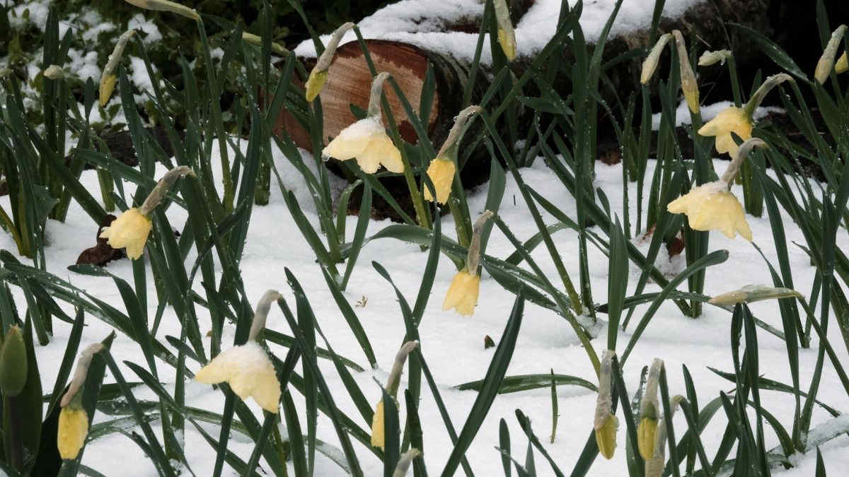
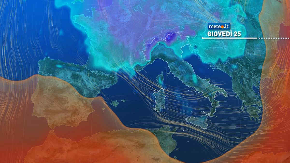
Al mattino nuvolosita' irregolare, piu' consistente nel settore tirrenico dove sara' associata a locali precipitazioni con possibili rovesci o temporali in Campania e neve fino ai 1200-1300 metri sull'Appennino campano e lucano. Temperature minime in calo. Nel pomeriggio ancora prevalenza di nuvole e locali precipitazioni su Campania, Potentino e Calabria. In serata possibili rovesci sulla Calabria tirrenica. Temperature massime in calo e comprese tra 11 e punte di 17-19 gradi. Venti moderati o tesi occidentali. Fino a mosso l'Adriatico, da mossi a molto mossi gli altri mari.

Notizie
TendenzaMeteo: stop al freddo nel weekend, ma arriva ancora qualche pioggia. La tendenza da sabato 27 aprile
Meteo: stop al freddo nel weekend, ma arriva ancora qualche pioggia. La tendenza da sabato 27 aprile
Gli aggiornamenti meteo confermano che già dal 25 aprile si attenua l'afflusso di aria fredda, con temperature anche oltre la norma nel weekend
Mediaset

Ultimo aggiornamento Mercoledì 24 Aprile ore 20:13

Copyright © 1999-2020 RTI S.p.A. Direzione Business Digital - P.Iva 03976881007 - Tutti i diritti riservati - Per la pubblicità Mediamond S.p.a. RTI spa, Gruppo Mediaset - Sede legale: 00187 Roma Largo del Nazareno 8 - Cap. Soc. € 500.000.007,00 int. vers. - Registro delle Imprese di Roma, C.F.06921720154