FacebookInstagramTwitterWhatsApp

Meteo Castelnuovo Don Bosco tra 9 giorni. Previsioni del tempo, precipitazioni, temperatura e venti

FacebookWhatsappTwitterTelegram

Castelnuovo Don Bosco
Notte
sereno notte
Mattino
prevalentemente soleggiato
Pomeriggio
soleggiato
Sera
sereno notte
  • 16°

    UV Normale 0

    ore

    sereno notte

    Umidità normale62%

    Raffiche normali6-13 Km/h

    Nord estNord E

  • 15°

    UV Normale 0

    ore

    sereno notte

    Umidità normale65%

    Raffiche normali6-13 Km/h

    Nord nord estNord NE

  • 14°

    UV Normale 0

    ore

    sereno notte

    Umidità normale69%

    Raffiche normali6-13 Km/h

    NordNord

  • 13°

    UV Normale 0

    ore

    sereno notte

    Umidità alta72%

    Raffiche normali6-13 Km/h

    Nord ovestNord O

  • 13°

    UV Normale 0

    ore

    sereno notte

    Umidità alta75%

    Raffiche normali5-12 Km/h

    Nord ovestNord O

  • 12°

    UV Normale 0

    ore

    sereno notte

    Umidità alta78%

    Raffiche normali5-11 Km/h

    Nord ovestNord O

  • 11°

    UV Normale 1

    ore

    soleggiato

    Umidità alta81%

    Raffiche normali4-10 Km/h

    Nord ovestNord O

  • 12°

    UV Normale 2

    ore

    soleggiato

    Umidità alta76%

    Raffiche normali4-10 Km/h

    Nord ovestNord O

  • 14°

    UV Normale 4

    ore

    prevalentemente soleggiato

    Umidità alta72%

    Raffiche normali3-9 Km/h

    Nord ovestNord O

  • 15°

    UV Normale 5

    ore

    prevalentemente soleggiato

    Umidità normale67%

    Raffiche normali3-8 Km/h

    Nord ovestNord O

  • 16°

    UV Elevato 6

    ore

    prevalentemente soleggiato

    Umidità normale62%

    Raffiche normali4-9 Km/h

    Ovest nord ovestOvest NO

  • 18°

    UV Elevato 7

    ore

    prevalentemente soleggiato

    Umidità normale58%

    Raffiche normali4-9 Km/h

    Ovest nord ovestOvest NO

  • 19°

    UV Elevato 9

    ore

    prevalentemente soleggiato

    Umidità normale53%

    Raffiche normali5-9 Km/h

    Ovest sud ovestOvest SO

  • 20°

    UV Elevato 10

    ore

    prevalentemente soleggiato

    Umidità normale49%

    Raffiche normali6-10 Km/h

    Ovest sud ovestOvest SO

  • 21°

    UV Elevato 9

    ore

    soleggiato

    Umidità normale44%

    Raffiche normali7-10 Km/h

    Sud ovestSud O

  • 23°

    UV Elevato 7

    ore

    soleggiato

    Umidità normale40%

    Raffiche normali7-10 Km/h

    Sud sud ovestSud SO

  • 24°

    UV Elevato 6

    ore

    soleggiato

    Umidità normale35%

    Raffiche normali8-12 Km/h

    Sud sud ovestSud SO

  • 23°

    UV Normale 5

    ore

    soleggiato

    Umidità normale37%

    Raffiche normali9-13 Km/h

    Sud ovestSud O

  • 21°

    UV Normale 4

    ore

    soleggiato

    Umidità normale39%

    Raffiche normali10-15 Km/h

    Sud ovestSud O

  • 20°

    UV Normale 2

    ore

    soleggiato

    Umidità normale40%

    Raffiche normali11-17 Km/h

    Ovest sud ovestOvest SO

  • 18°

    UV Normale 1

    ore

    soleggiato

    Umidità normale42%

    Raffiche normali11-18 Km/h

    Ovest sud ovestOvest SO

  • 17°

    UV Normale 0

    ore

    sereno notte

    Umidità normale44%

    Raffiche forti12-20 Km/h

    Ovest intensoOvest

  • 16°

    UV Normale 0

    ore

    sereno notte

    Umidità normale48%

    Raffiche normali11-18 Km/h

    Ovest nord ovestOvest NO

  • 16°

    UV Normale 0

    ore

    sereno notte

    Umidità normale52%

    Raffiche normali9-16 Km/h

    Nord ovestNord O

  • 15°

    UV Normale 0

    ore

    sereno notte

    Umidità normale55%

    Raffiche normali7-14 Km/h

    NordNord

Meteo provincia di Asti
Meteo Nord-Ovest Italia
Oggi

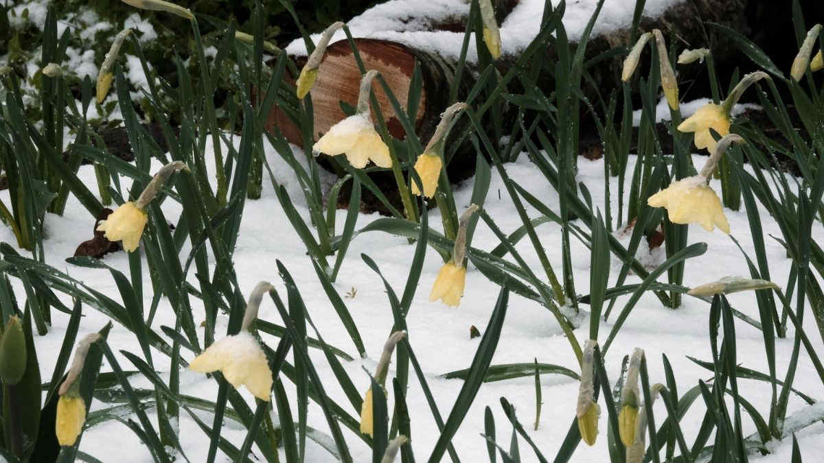
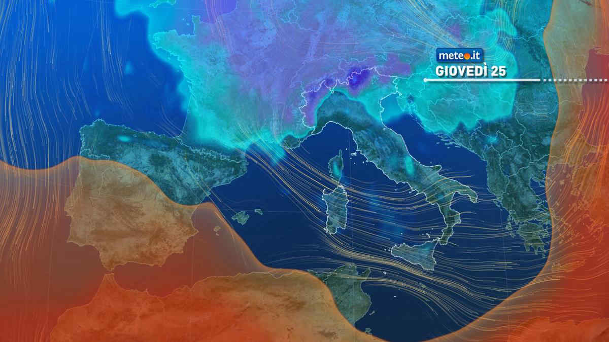
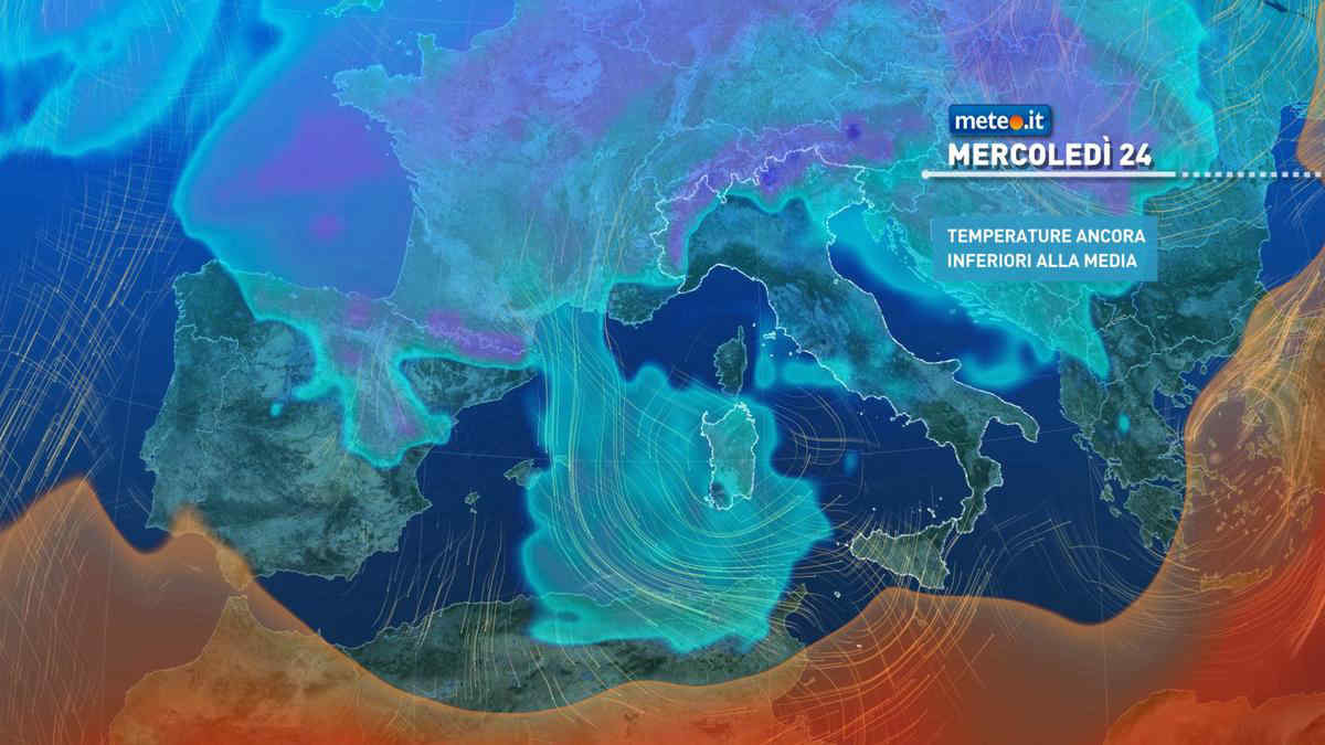
Al mattino cielo molto nuvoloso o coperto con precipitazioni sparse in Lombardia, Piemonte orientale e meridionale e Appennino Ligure. Limite delle nevicate intorno ai 600-800 metri. Temperature minime in lieve calo. Nel pomeriggio ancora nuvoloso ovunque. Possibili piogge intermittenti in Lombardia, alto Piemonte e Ponente ligure; neve su Alpi lombarde e occidentali e Appennino Ligure oltre 800-1100 metri. Miglioramento in serata. Temperature massime in rialzo, ma sempre sotto la media. Un po' ventoso per venti settentrionali, specie in Liguria. Mar Ligure poco mosso sotto costa, mosso al largo.

Notizie
TendenzaMeteo, 25 aprile freddo e a rischio pioggia: inverno protagonista per tutto il ponte? La tendenza
Meteo, 25 aprile freddo e a rischio pioggia: inverno protagonista per tutto il ponte? La tendenza
Si confermano condizioni meteo variabili e aria fredda anche giovedì 25 aprile 2024, festa della Liberazione: come prosegue il ponte? La tendenza
Mediaset

Ultimo aggiornamento Martedì 23 Aprile ore 16:14

Copyright © 1999-2020 RTI S.p.A. Direzione Business Digital - P.Iva 03976881007 - Tutti i diritti riservati - Per la pubblicità Mediamond S.p.a. RTI spa, Gruppo Mediaset - Sede legale: 00187 Roma Largo del Nazareno 8 - Cap. Soc. € 500.000.007,00 int. vers. - Registro delle Imprese di Roma, C.F.06921720154